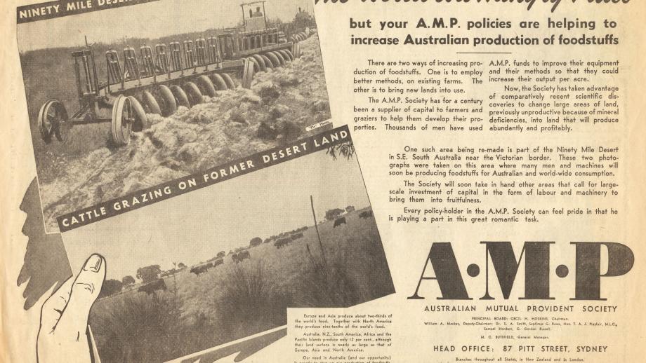
Desert Conquest and Rural Development

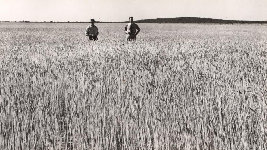
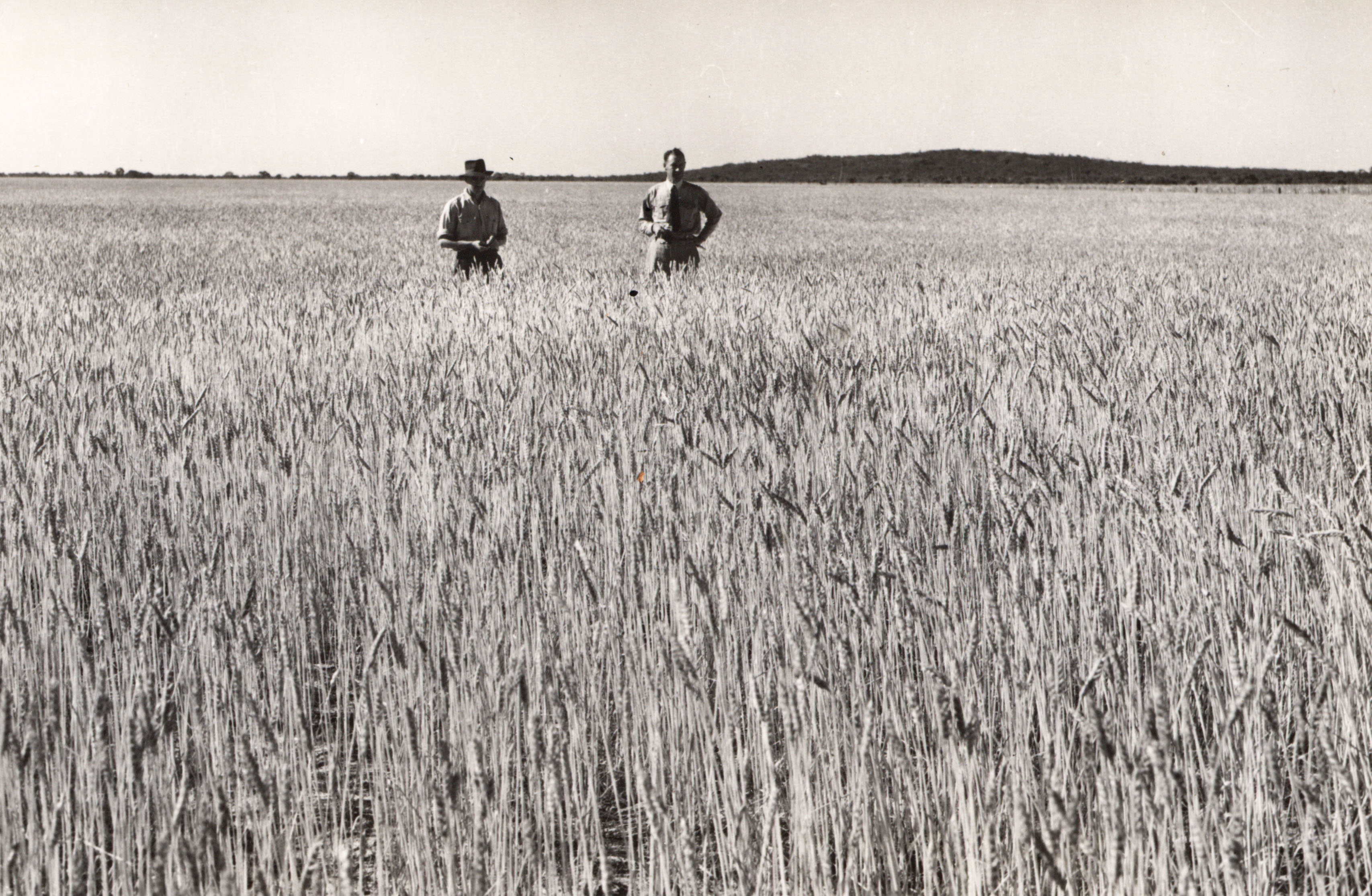
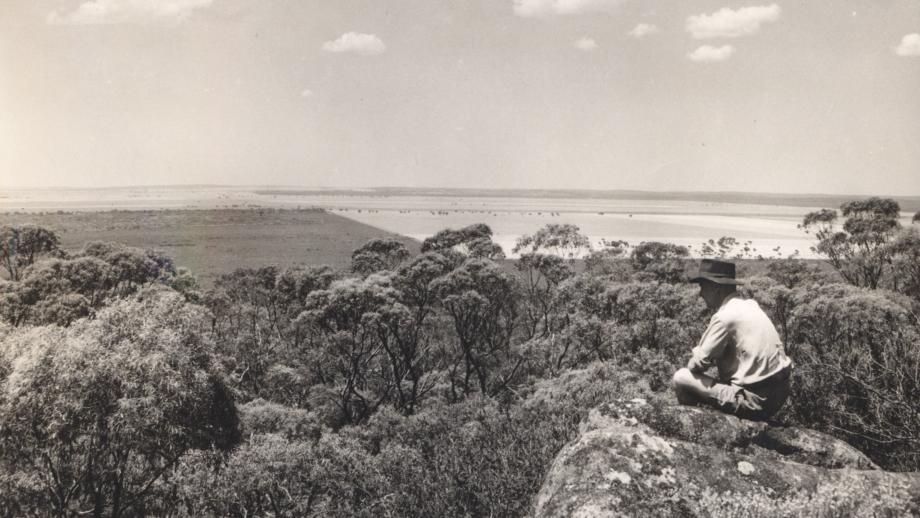
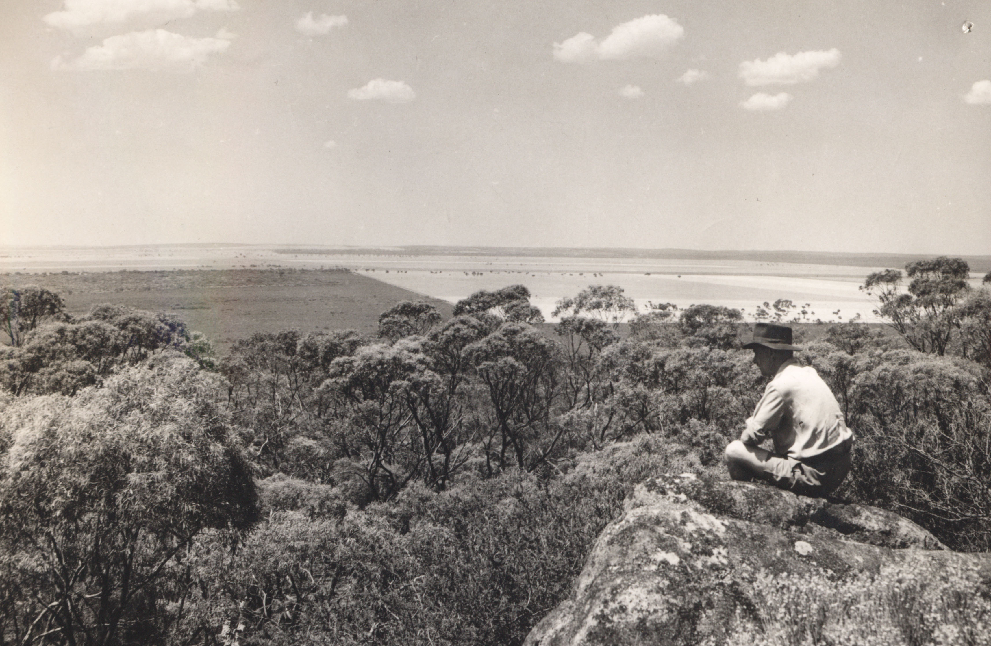
For 175 years AMP has been known as an insurance and financial services company, but less people know of its involvement in land and property development. In 1949 AMP decided to develop an area of 2,000 square miles near the South Australian-Victorian border known as Ninety Mile Desert, using “the latest scientific methods of treating seemingly useless desert land”. While the area wasn’t technically a desert, it was considered very poor-quality land, but reliable rainfall and a good clay subsoil meant AMP saw potential in its development for agriculture if the soil was improved through “modern science”. Development would address critical food and housing shortages. If successful, the land would be subdivided and used primarily for closer settlement, which involved the development of land into holdings large enough to support a family and realise the land’s full potential, usually via agriculture (Gammage, 2024).  

AMP named the area Coonalpyn Downs, a more attractive name than Ninety Mile Desert. Sheep flocks were moved to the area once the first scrubland was cleared, and AMP was thrilled by the high prices wool was selling for at the time.

A typical farm comprised 1,000 acres. By the end of 1957, AMP had settled 79 families and during the early 1960s developed a further 96,000 acres in Victoria (Blainey, 1999). However, by the late 1960s state governments were becoming more opposed to widespread clearing of scrubland and AMP was less inclined to engage in these developments, and so its last land was sold off in South Australia in 1965 and in Victoria in 1973 (Blainey, 1999).

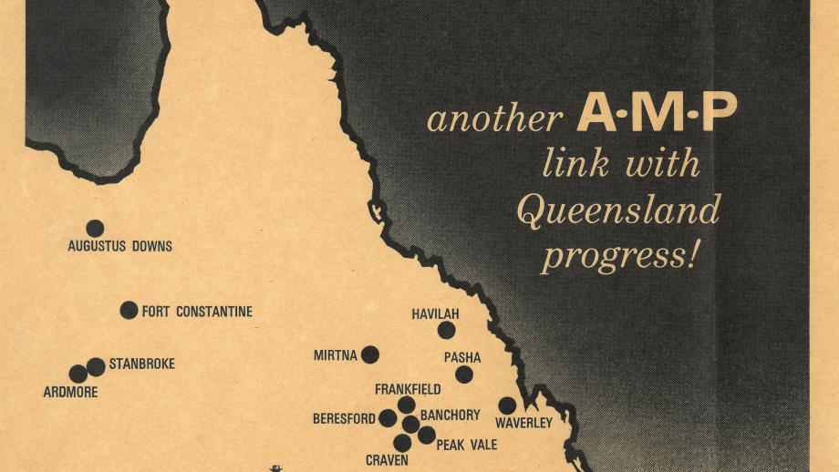
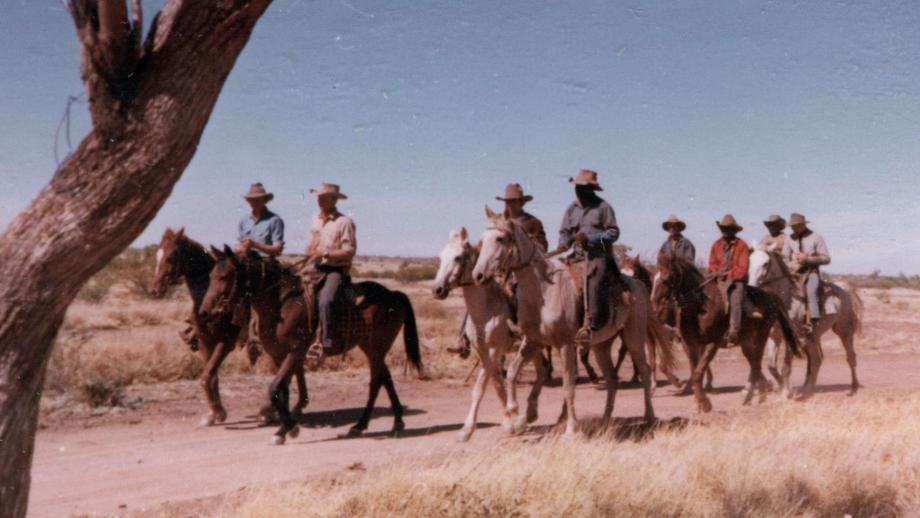
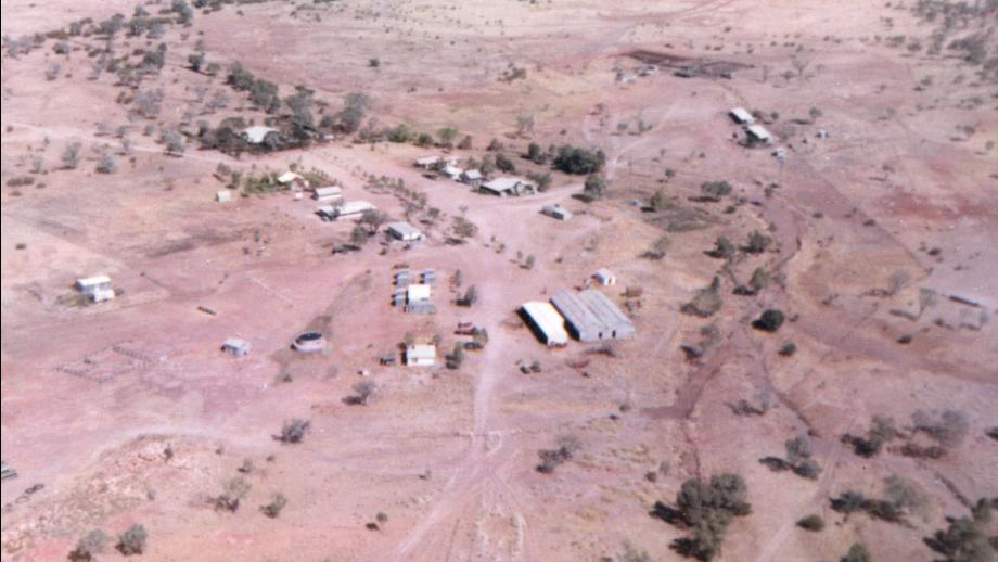
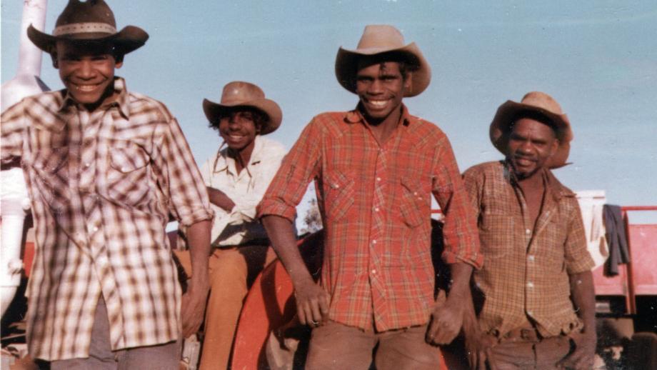
However, AMP had not lost its enthusiasm for agriculture. In 1964, it went into partnership with the London-based company Thomas Borthwick & Sons, which operated cattle stations and a meat exporting business in Australia. This led to the formation of the Stanbroke Pastoral Company, which within two years was operating thirteen pastoral stations in Queensland running approximately 70,000 cattle and 35,000 sheep (Blainey, 1999). By 1969, the number of cattle had grown to 182,000 and AMP had acquired 50% of the Northern Cattle Company which operated stations in Western Australia. In 1983 AMP became the sole owner of Stanbroke, and in doing so it now operated the largest cattle company in Australia, with 27 stations and approximately 475,000 cattle (Blainey, 1999).


Wheat crops at Ninety Mile Desert (Coonalypn Downs), South Australia, c. 1950s (N434-1304-36).

Wheat crops at Ninety Mile Desert (Coonalypn Downs), South Australia, c. 1950s (N434-1304-36).

Wheat crops at Ninety Mile Desert (Coonalypn Downs), South Australia, c. 1950s (N434-1304-36).
View over Ninety Mile Desert (Coonalpyn Downs), South Australia, c. 1950s (N434-1304-01).

View over Ninety Mile Desert (Coonalpyn Downs), South Australia, c. 1950s (N434-1304-01).

View over Ninety Mile Desert (Coonalpyn Downs), South Australia, c. 1950s (N434-1304-01).
Housing at Ninety Mile Desert (Coonalpyn Downs), South Australia, c. 1950s (N434-1304-05).

Building at Ninety Mile Desert (Coonalpyn Downs), South Australia, c. 1950s (N434-1304-05).

Housing at Ninety Mile Desert (Coonalpyn Downs), South Australia, c. 1950s (N434-1304-05).
Building at Ninety Mile Desert (Coonalpyn Downs), South Australia, c. 1950s (N434-1304-05).
Making improvements to the land at Ninety Mile Desert (Coonalpyn Downs), South Australia, c. 1950s (N434-1304-20).

Making improvements to the land at Ninety Mile Desert (Coonalpyn Downs), South Australia, c. 1950s (N434-1304-20).

Making improvements to the land at Ninety Mile Desert (Coonalpyn Downs), South Australia, c. 1950s (N434-1304-20).
Development at Ninety Mile Desert (Coonalpyn Downs), South Australia, c. 1950s (N434-1304-06).

Development at Ninety Mile Desert (Coonalpyn Downs), South Australia, c. 1950s (N434-1304-06).

Development at Ninety Mile Desert (Coonalpyn Downs), South Australia, c. 1950s (N434-1304-06).
Advertisement for the Ninety Mile Desert development, South Australia, Sunday Herald, 1951 (N434).

Advertisement for the Ninety Mile Desert development, South Australia, Sunday Herald, 1951 (N434).

Advertisement for the Ninety Mile Desert development, South Australia, Sunday Herald, 1951 (N434).
Advertisement for the Stanbroke Beef Development Project, 1960s (N434).

Advertisement for the Stanbroke Beef Development Project, 1960s (N434).

Advertisement for the Stanbroke Beef Development Project, 1960s (N434).
Brochure for AMP's Ninety Mile Desert Development, 1950s (N434-669).

Brochure for AMP's Ninety Mile Desert Development, 1950s (N434-669).

Brochure for AMP's Ninety Mile Desert Development, 1950s (N434-669).
Map of the Ninety Mile Desert area, South Australia, 1950s (N434-669).

Map of the Ninety Mile Desert area, South Australia, 1950s (N434-669).

Map of the Ninety Mile Desert area, South Australia, 1950s (N434-669).
Stockmen leaving for muster from Moola Bulla Station, Western Australia, 1972 (N434-1305-34).

Stockmen leaving for muster from Moola Bulla Station, Western Australia, 1972 (N434-1305-34).

Stockmen leaving for muster from Moola Bulla Station, Western Australia, 1972 (N434-1305-34).
Aerial view of Moola Bulla Station, Western Australia, 1972 (N434-1305-07).

Aerial view of Moola Bulla Station, Western Australia, 1972 (N434-1305-07).

Aerial view of Moola Bulla Station, Western Australia, 1972 (N434-1305-07).
Workers at Moola Bulla Station, Western Australia, 1972 (N434-1305-15).

Workers at Moola Bulla Station, Western Australia, 1972 (N434-1305-15).

Workers at Moola Bulla Station, Western Australia, 1972 (N434-1305-15).