The Move Inland
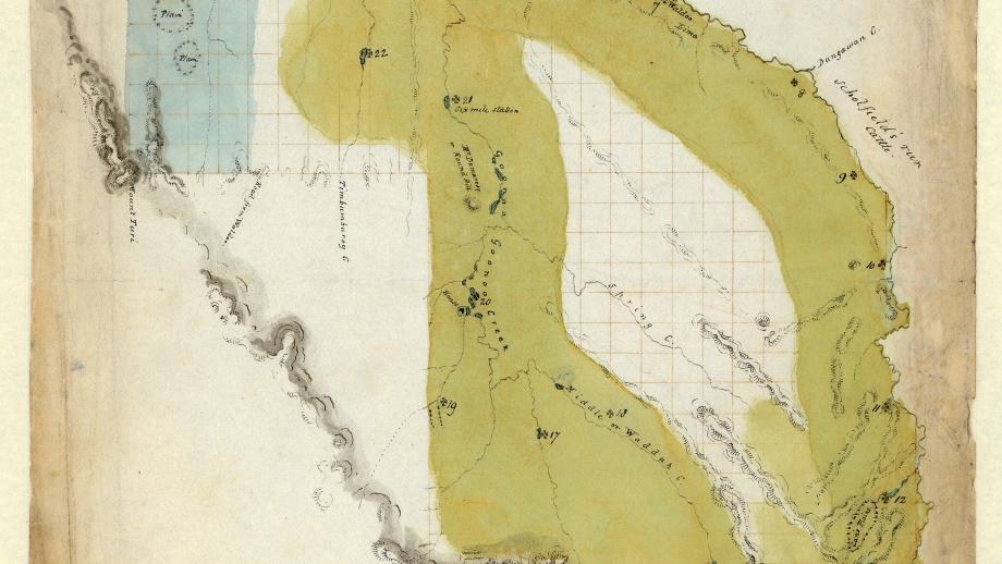
By the early 1830s it had become abundantly clear that the Company’s flock were not thriving at Port Stephens. Chief Agent Robert Dawson had been under considerable pressure to settle on the Company's initial land grant and had erred in choosing to take the whole grant in the area between Port Stephens and the Manning River. As Atchison (1970) suggests, Dawson made an inadequate examination of the eastern section of the grant, with the varied requirements of his position not allowing him time to conduct adequate experiments with sheep and wool production in the area. His reliance on the judgements of his assistants and the pressure from the Colonial Secretary and Survey Department to produce a formal delineation of the grant, resulted in a decision that may well have been very different if given more time. The flock struggled at Port Stephens, with low birth rates and high mortality. By the time Sir William Parry had taken over as Commissioner in 1830, it was obvious the Company’s venture to raise fine-wooled sheep in the colony would fail if more suitable land was not found.
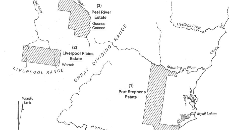
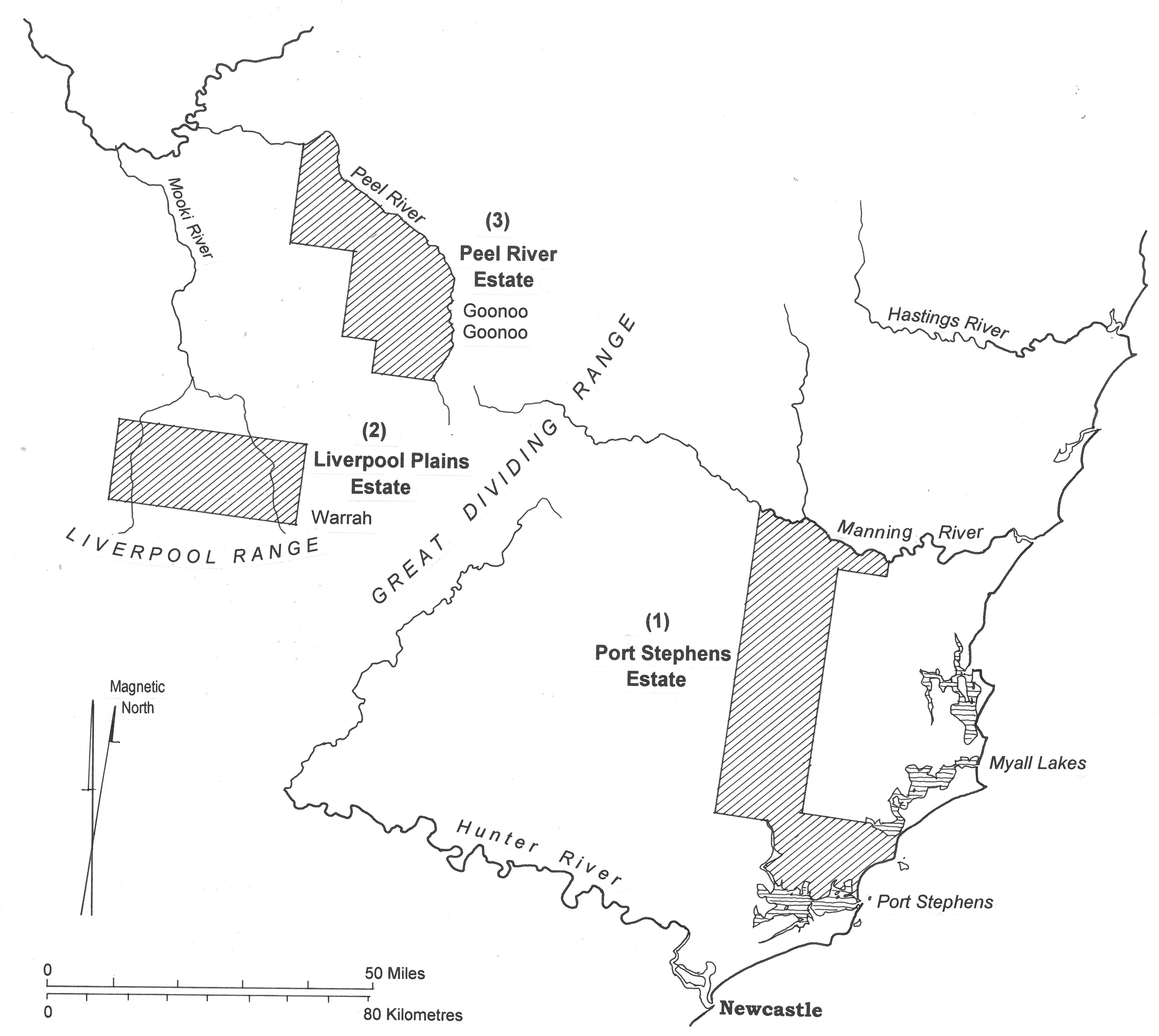
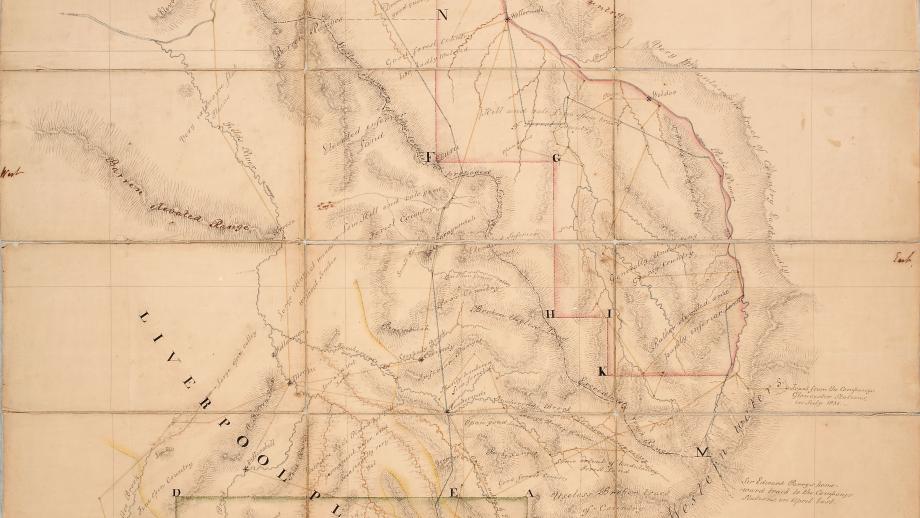
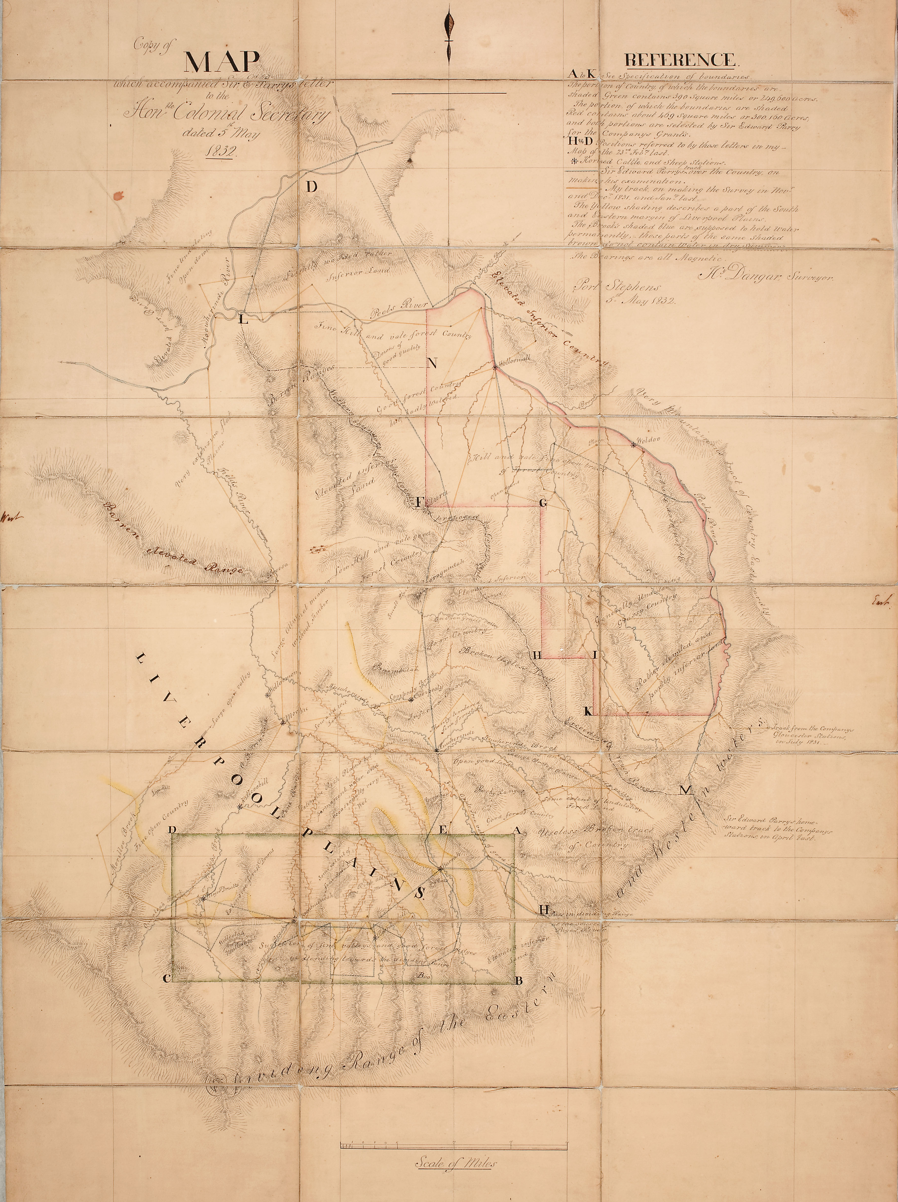
Parry, aided by his assistants Alexander Nisbet and Henry Dangar, explored new options for suitable land to graze the Company’s flock. Initially Parry was reluctant to move inland and instead researched options north of Port Macquarie and south of Sydney, but Dangar was able to persuade him that lands around the Liverpool Plains and Peel River were more promising. Dangar conducted a detailed survey of these areas in 1831 and after visiting the region in March 1832, Parry was convinced and applied to Governor Sir Richard Bourke for two large grants on the Liverpool Plains west of Willow Tree and the Peel River south of Tamworth in exchange for surrendering land at Port Stephens. This would prove vital in ensuring the success of the Company.
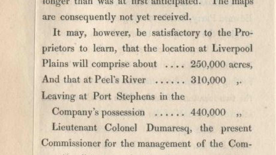
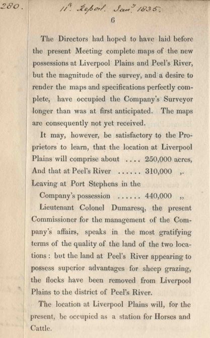
In August 1833 Parry was advised the Colonial Office had agreed to the Company’s new land grants consisting of 464,640 acres in the western section of the original Port Stephens Estate, 249,000 acres on the Liverpool Plains (Warrah), and 213,000 acres near the Peel River (Goonoo Goonoo).
Having settled the exchange of unsuitable land in the eastern part of the Company’s Port Stephens Estate, plans were made to develop pastoral stations at Warrah on the Liverpool Plains and Goonoo Goonoo in the Peel Valley. Both estates were very successful for the Company, with its flock much better suited to the conditions in these locations.
References
Atchison, J.F. 1970, ‘Archives of a Joint-Stock Company. The Australian Agricultural Company; its system of administration and its records, 1824-1970, Archives & Manuscripts: The Journal of the Australian Society of Archivists, vol. 4, no. 3, <https://publications.archivists.org.au/index.php/asa/article/view/6009>