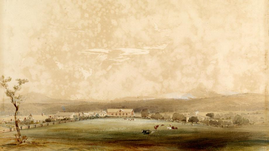
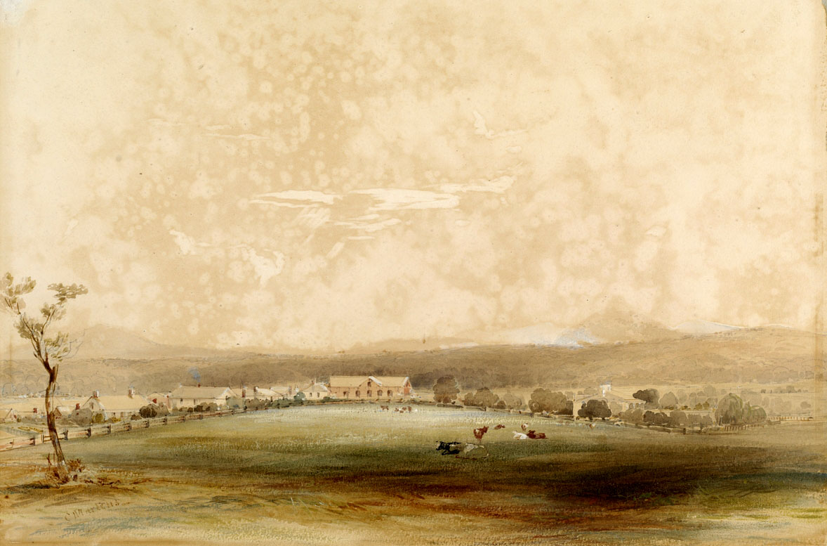
Booral
Booral is located approximately 30 km north of Carrington and Tahlee and 7 km from Stroud. The location was chosen for development by the Company as it was surrounded by country ideal for farming and its location at the head of navigation of the Karuah River allowed for easier transportation of goods and made it the closest navigable point to Stroud.
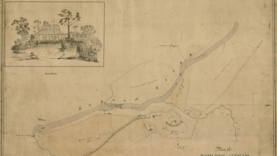
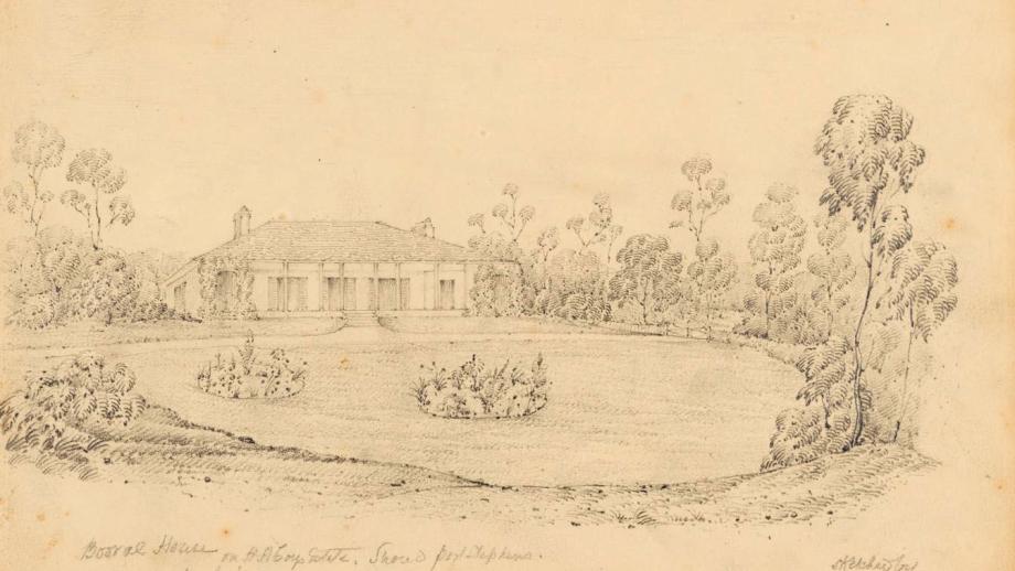
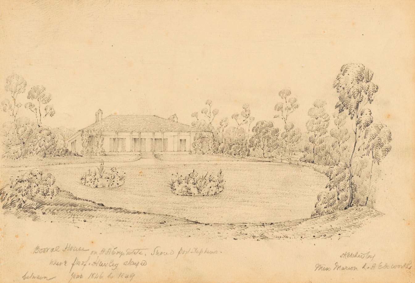
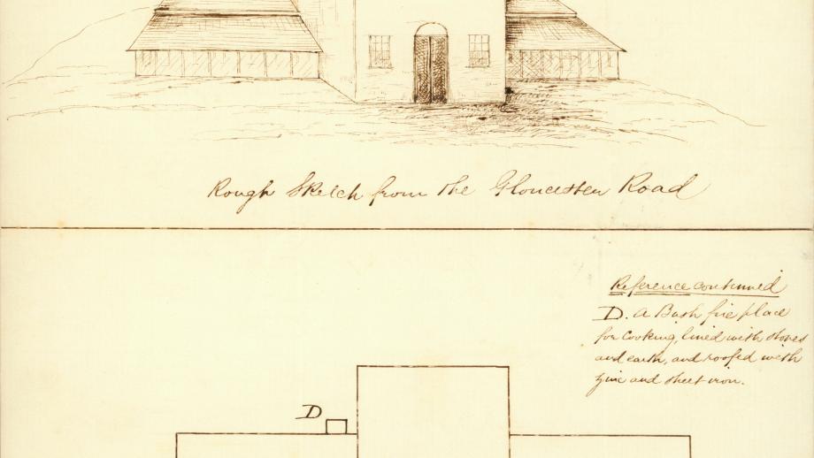
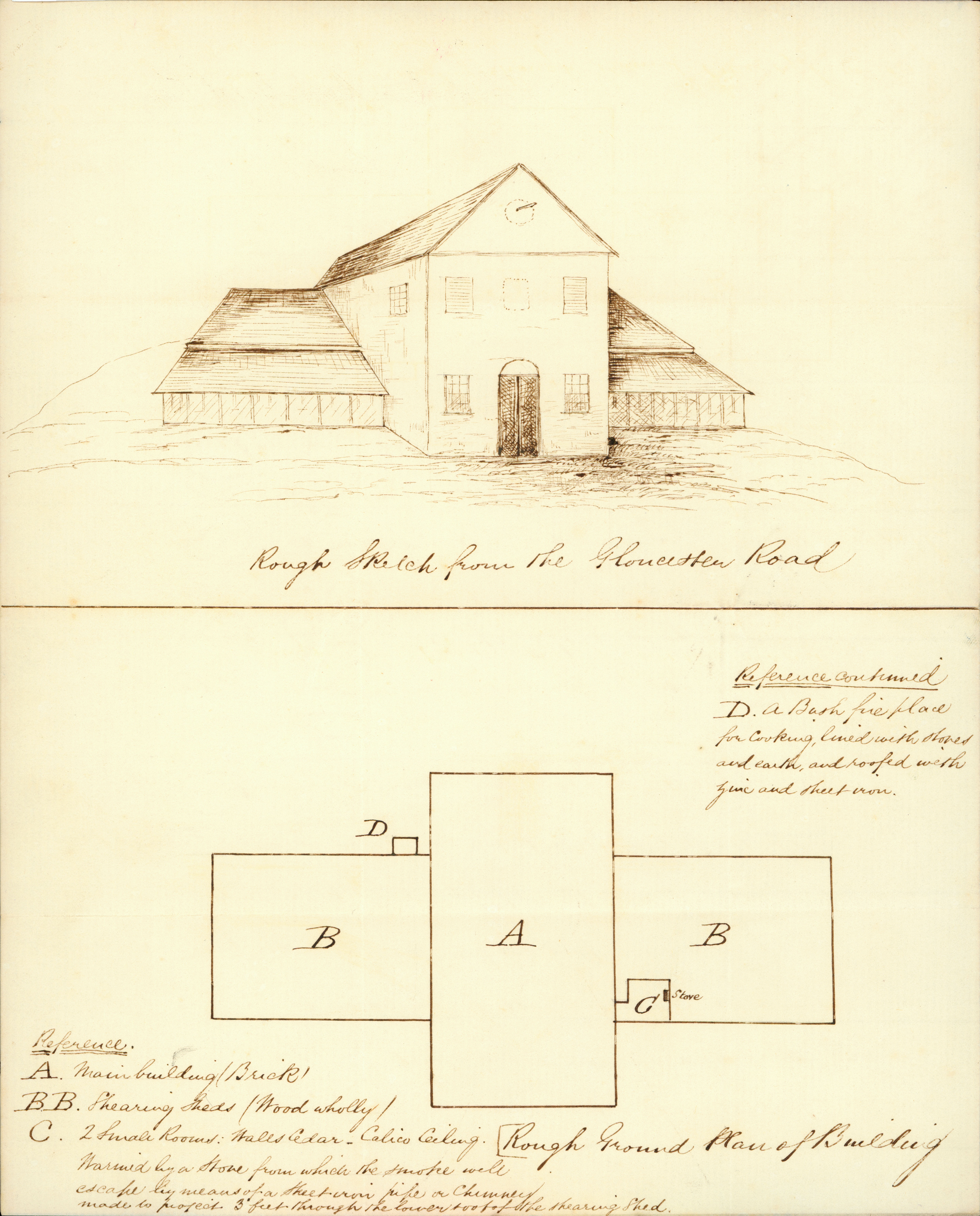
Booral House was built by convict labour in 1831 as a residence for the chief servants of the Company, the first of which was the Superintendent of Agriculture Mr William Burnett. It was designed as “a showplace, a majestic homestead with spacious gardens and much the envy of the other officers in the Company” (Bailey 1989). The Company Accountant and later Acting Commissioner and General Superintendent James Ebsworth lived at Booral House as well as Deputy Governor / Acting General Superintendent Archibald Blane, who also died there. Booral House was leased out by the Company in 1856 before being sold in 1873.
The Company needed to transport goods to and from its estates and under Commissioner Henry Dumaresq, a wharf was constructed approximately one mile south of Booral. The Karuah River was wide and deep, and this location allowed for ships of up to 30 tonnes to dock. A temporary store was also erected nearby, replaced in 1837 by a permanent structure.
By 1856, the Company had erected a wharf and store at Pumpkin Point, further downstream from Booral. Pumpkin Point had become preferable to Booral as it was able to accommodate ships larger than 30 tonnes. The Company leased Booral Wharf and Store privately until the 1870s, by which time the inland roads were sufficient to handle the transportation of goods and stock overland rather than by sea and the wharf was no longer needed.
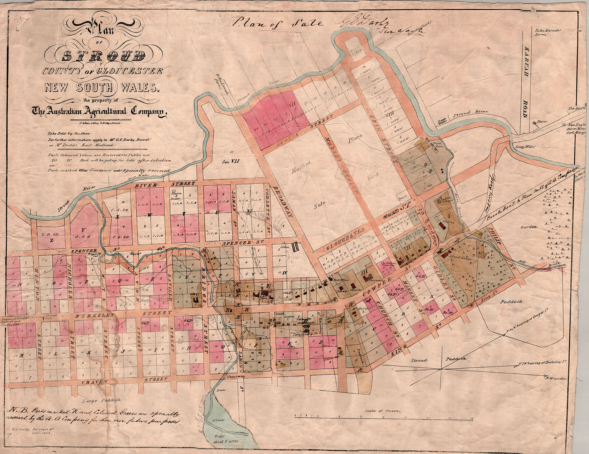
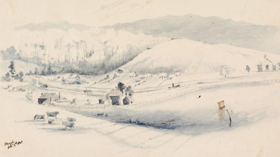
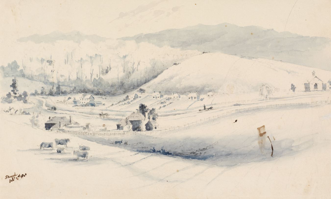
Stroud
Stroud is Australia’s oldest surviving ‘company town’, with many buildings from the 1800s still standing today. In late 1826 Dawson set out to explore the area north of Carrington with the aim of establishing an inland village. He chose an area between the Karuah River and Mill Creek which he named Stroud as it reminded him of Stroud in England, an area renowned for its wool and where much of the wool the Company hoped to produce was intended to be shipped.
To help construct and establish the Company’s settlements at Booral and Stroud, the Colonial Government assigned convict labour. By 1828 there were 180 convicts working for the Company, although convict labour was in very short supply. Some of the buildings worked on by convicts included the school house (1831), store (1831), renovations to Stroud House (1832), a cottage for Superintendent of the Flocks (1832), slaughterhouse (1832), Booral House (1831-33), mill house (1833), St John’s Anglican Church (1833), mill (1834), Telligherry Woolshed (1835), rectory (1836), Quambi school house, eight underground grain silos (1841) and the courthouse (Stroud & District Historical Society 2021). By 1836 most of the Company’s officers, mechanics, blacksmiths, wheelwrights, carpenters, joiners, and convict labour force were based in Stroud.
Initially the areas around Stroud and Telligherry were used for grazing sheep, with washing and shearing undertaken at Washpool on the Karuah River.
The 1840s was a period of severe economic depression in Australia. Against this backdrop and following the obtainment of their grant and subsequent right to sell land, the Company attempted to launch a Colonisation Scheme, noting that part of the original Company charter was to encourage new settlers to Australia. Lots of 50 acres were offered for sale but there was little interest and only 29 sales certificates were issued.
In the early 1850s, the Company again attempted to encourage greater interest in Stroud. In 1851 Commissioner Blane officially moved the Company’s centre of operations to Stroud from Carrington. Commissioner Brownrigg moved the Company’s annual stock sale from Maitland to Stroud. Improvements were made to the road between the Company’s Port Stephens and Peel Estates, known as the Company Line, and a monthly steamer service began between Booral and Sydney. Despite this, by 1856 only 24 farmers had moved to the area (Stroud & District Historical Society 2021).
In 1857 General Superintendent Arthur Hodgson made an application to the government to proclaim Stroud a venue for the Court of Petty Sessions, as well as a place where alcohol could be sold and the Towns Police Act applied, thus making Stroud a ‘public town’ (Stroud & District Historical Society 2021). That same year, the Company advertised all its Port Stephens flocks for sale, followed by all its houses in Stroud in 1858. By 1864 nearly all the land in and around the Port Stephens Estate had been leased or sold by the Company as it focused on its operations on the Peel and Warrah Estates.
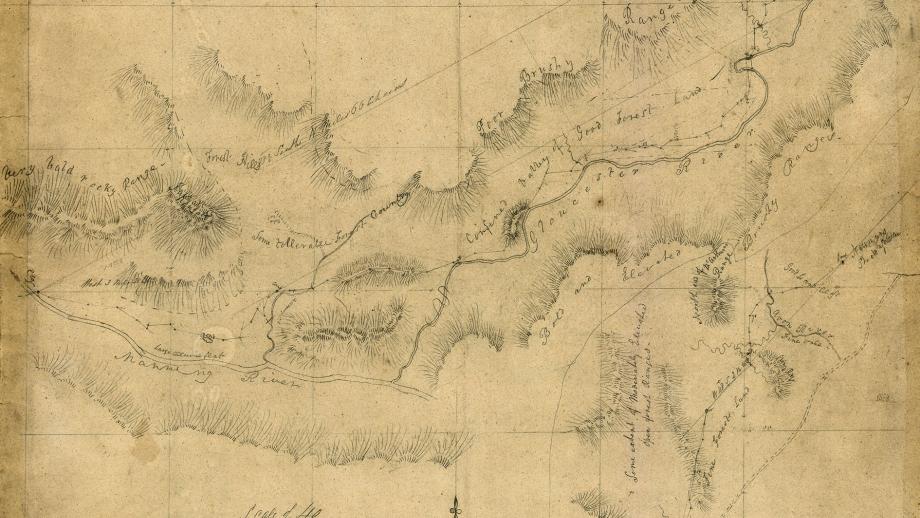
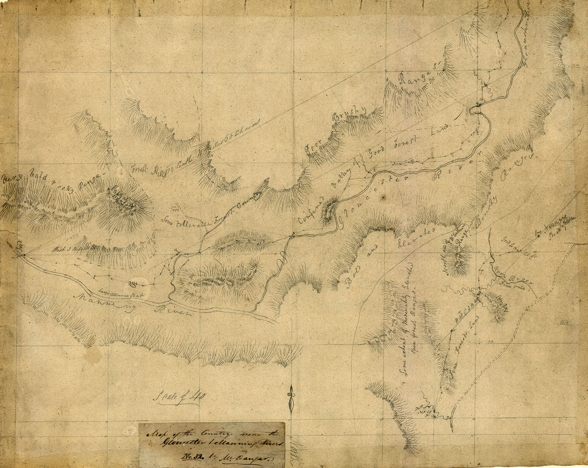
Gloucester
Gloucester is in the northern part of the Company’s former Port Stephens Estate. Chief Agent Robert Dawson named the valley here the ‘Vale of Gloucester’. In 1829, the Australian Agricultural Company’s Committee, at the direction of the Court, wrote to the Colonial Secretary asking that the area around their estate be named the County of Gloucester after the English county “in which the finest wools are manufactured into cloth” [Brickwood to Dawson, 78-9-1, p 253]. The County was gazetted in October 1829.
In 1834, Gloucester became a horse outstation before becoming a cattle station breeding pure bred shorthorn cattle.
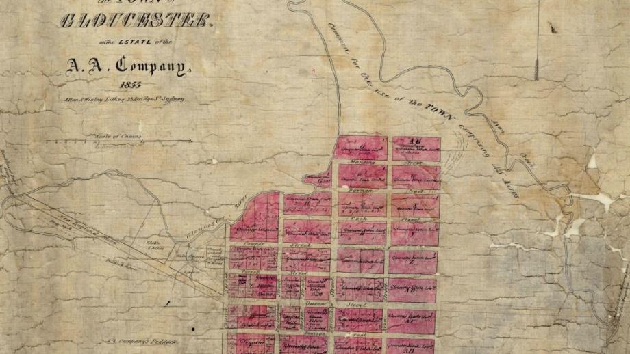
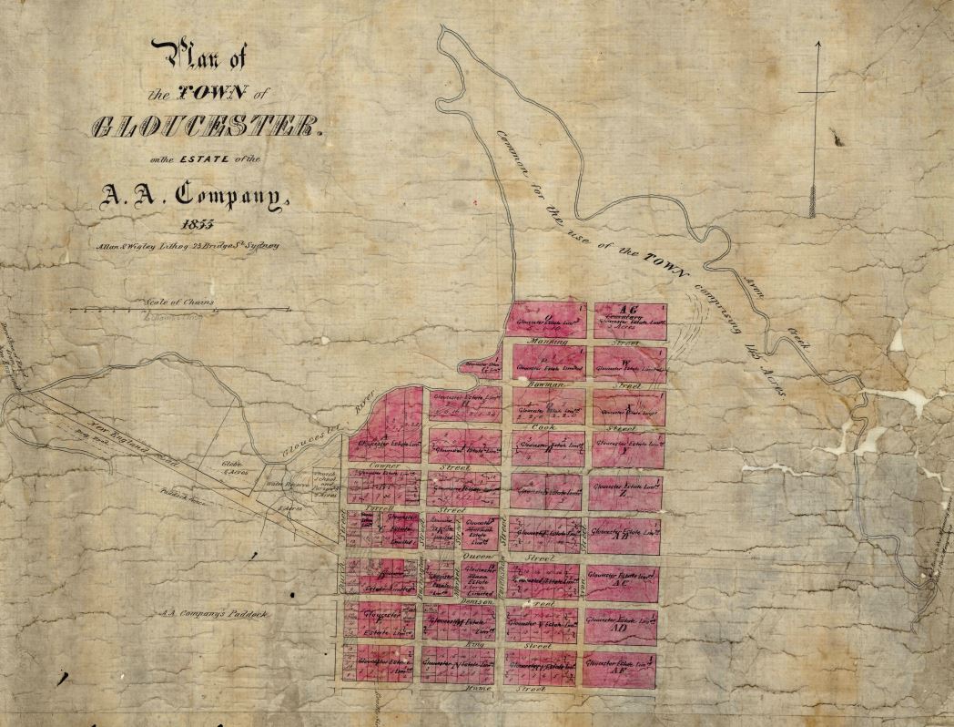
The Company laid out the village of Gloucester in 1855, with the location of the town chosen for its pleasant view of rolling hills and valleys in all directions. The first Anglican Church was built by the Company in 1860 and serviced by the Minister from Stroud.
Initial land sales were poor and Gloucester's population in 1866 was just 30 people. By the end of the century, the Gloucester cattle run, 206,579 acres, was all that remained of the Company’s Port Stephens Estate. In 1903 it was sold to development syndicate, the Gloucester Estate Ltd for 12/6 an acre. Judicious subdivision and good promotion, assisted by the development of the North Coast Railway (Gloucester Station opened 1913), resulted in rapid growth with land selling at between 20 shillings and £5 an acre by the end of 1903.
Tea Gardens
A community of oyster farmers, timber getters and lime-burners developed on the Myall River, on the eastern edge of the Australian Agricultural Company’s Bundobah cattle run on the Port Stephens Estate.
In 1866 Edward Davies of Bulahdelah approached the Company asking for a lease of some land in this area on the Myall River at ‘The Teagardens’. The origin of the name is uncertain.
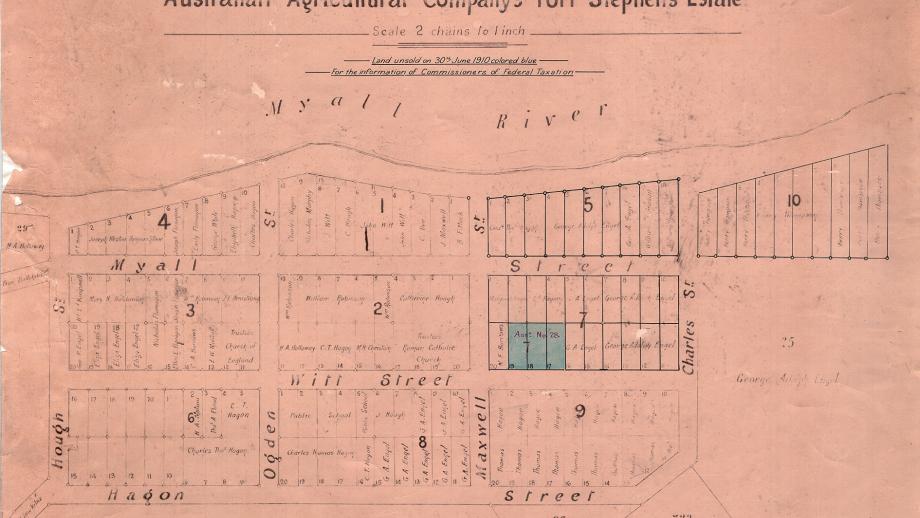
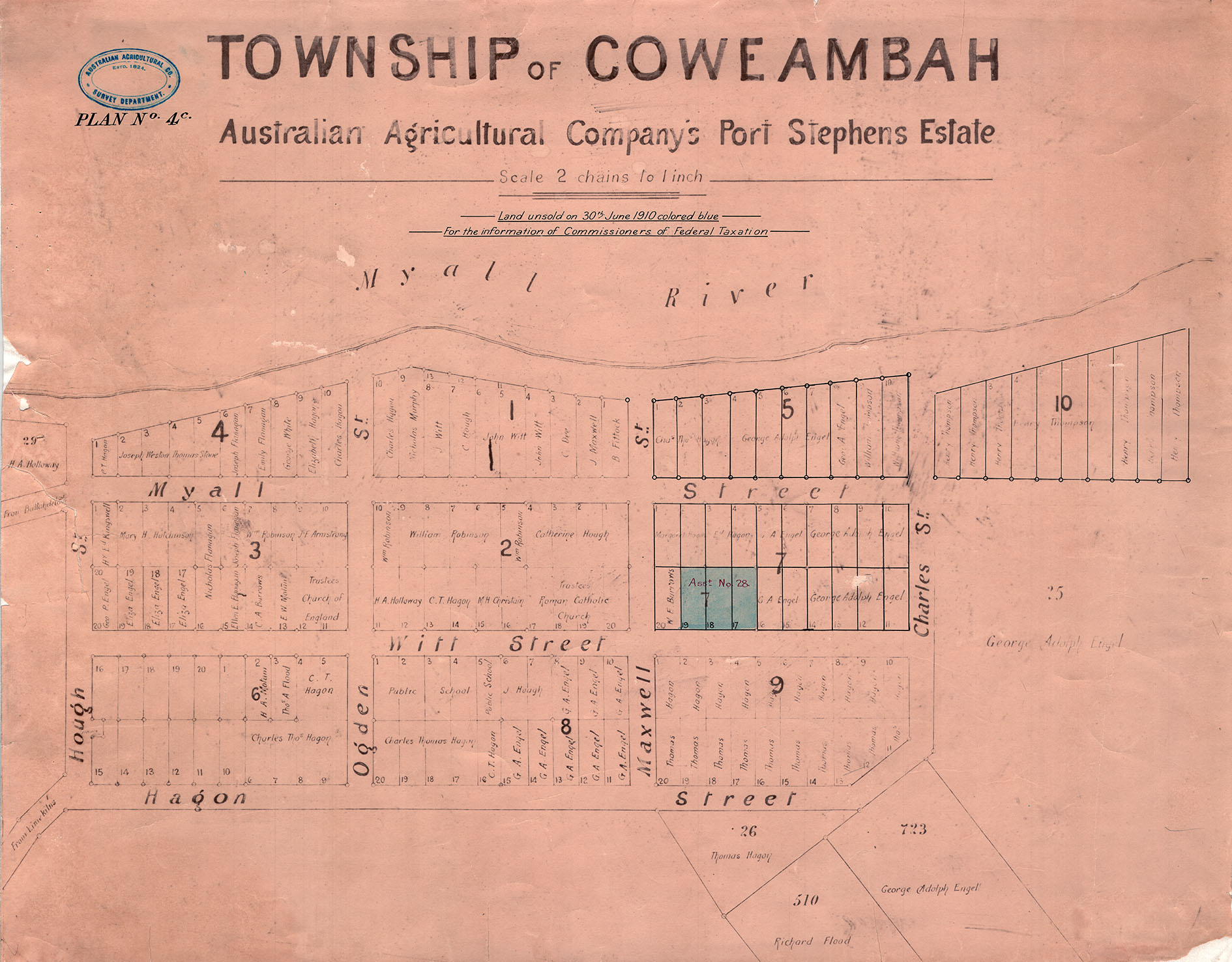
Surveyor George Ogden laid out the village of Myallton / Coweambah / Tea Gardens in 1866 and the town lots sold slowly. Another village, Hawks Nest, developed opposite Tea Gardens, on government land, between the Myall River and the Pacific Ocean.
In the twentieth century, the towns became very popular holiday destinations, especially after the realignment of the Pacific Highway from the 1950s. In 1974 the ‘Singing Bridge’ linked the towns, replacing the vehicle punt and allowing for easier access.
References
Bailey, J 1989, The Australian Agricultural Company, University of Newcastle,<https://uoncc.files.wordpress.com/2015/11/a6963iii_eggeltonsavage.pdf>
Stroud & District Historical Society 2021, Stroud’s history, <https://www.stroudhistoricalsociety.com/strouds-history>