Burns Philp
Burns Philp was a major shipping line and acted as merchants and agents in the Pacific Islands, as well as providing a mail service and carrying tourists to various Pacific locations, including the New Hebrides (now Vanuatu). In later years, Burns Philp also acquired land and developed plantations throughout the Pacific region. The images below are just a sample of the materials relating to Vanuatu in the Burns Philp deposits in the archives.

Burns Philp travel advertisement


A travel advertisement for the New Hebrides appearing in the Burns Philp (B.P.) Magazine, 1 December 1940


1933 Burns Philp list of sailings from Australia ((N115-626)


Entry for New Hebrides in Burns Philp travel advertisement booklet, Tours to the South Sea Islands (N115-626)


The description of the New Hebrides in the Java and Pacific Islands Tours advertising booklet by Burns Philp, page 88 (N115-626)


This is one of several images of the New Hebrides (Vanuatu) that were included in the Burns Philp advertising booklet, Java & Pacific Islands Tours. (N115-626)


Image of Malo, New Hebrides [Vanuatu] in Burns Philp & Co.'s Java & Pacific Islands Tours booklet, page 89


Image of Native Church in Aoba [Ambae, Vanuatu] in Java & Pacific Islands Tours booklet, page 90


Image of people fishing in Tangoa, Vanuatu from Burns Philp Java & Pacific Islands Tours booklet, page 91


Image of hut, Pango New Hebrides [Vanuatu] from Burns Philp's Java & Pacific Islands Tours booklet, page 92


Image of Iririki, Vila, New Hebrides [Vanuatu] from Burns Philp's Java & Pacific Islands Tours booklet, page 93


Image entitled 'An Island Homestead- Iririki, Vila, New Hebrides' from Burns Philp's Java & Pacific Islands Tours booklet, page 94 [N115-626]


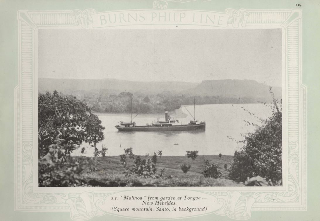
View of S. S. Malinoa from Tongoa with Santo in background, from Burns Philp's Java & Pacific Islands Tours booklet, page 95 [N115-626]

A Burns Philp land lease for land called Namalo and Naone on the south side of Santo


This image was included in Picturesque Travel magazine, 1911, page 44, Burns, Philp & Company's Store in Vila [N115-625]

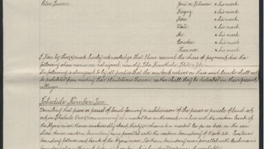
This lease from Burns Philp shows the agreements they had made with the traditional owners of the land, the rights of the owners, and a hand-drawn map showing the land known as Namal and Naone. [N115-154B-47]


This map shows European land claims on Espiritu Santo, between the Atzone (Adsone) and Wailapa rivers.


This Burns, Philp & Company route map circa 1930 shows the routes taken by the shipping line to the New Hebrides [Vanuatu]. (N115-626)


Travel brochures (circa 1960-1980) for the New Hebrides (Vanuatu)
